For physical network inventory systems, especially for fiber networks, versioning is a crucial concept. Versioning allows network planners and engineers to manage multiple states of a network, including how the network currently exists (as-built) and how it is planned to be (future state). Traditional versioning methods, however, come with significant challenges. In this blog, we will explore these challenges and the alternative provided by 3-GIS.
Understanding traditional versioning
Versioning in the context of network planning involves creating separate versions or views of the network to work on proposed changes without affecting the live (as-built) network data. Typically, this is done to allow different teams or individuals to work on various network modifications simultaneously. However, this process can become incredibly complex and resource intensive.
Imagine a simple network: a fiber cable running into a splice box and out again. When a planner wants to extend the network, they create a version of this network, draw in the new cable, and connect it to the splice box. Meanwhile, other planners might create their own versions for different projects, each seeing the network as it existed when they started their work. This can lead to multiple versions of the network being edited simultaneously without awareness of each other's changes.
This scenario often leads to significant issues:
- Conflict management: Multiple users may attempt to use the same fibers or ports for different projects, creating conflicts.
- Reconciliation: Once the planning is done, all these versions need to be reconciled with each other to ensure no conflicts exist before merging into the as-built network. This process can be both time-consuming and expensive.
- Maintenance downtime: Reconciliation often requires system downtime, which can be impractical for large-scale networks operating on a 24/7 basis.
The 3-GIS approach
3-GIS offers a different approach to versioning that eliminates many of the issues inherent in traditional methods. Here’s how it works:
Unified planned network database: Instead of creating multiple versions for every new project, 3-GIS employs a single planned network database. This database includes all proposed changes and planned features, allowing everyone to work within the same view of the network.
Single source of truth: By maintaining a unified planned network, all users see the most up-to-date changes made by others. This real-time visibility ensures that when a planner adds a new connection or feature, everyone else working on the network can immediately see this update.
First-come, first-serve: Changes are applied in real time, meaning the first person to use a particular fiber or port will block it from being used by others, preventing conflicts at the source.
In the 3-GIS system, reconciliation happens continuously. Since all planners work in a single, unified planned database, their changes are effectively reconciled in real time as they work. When one planner connects a new fiber, other planners will instantly see this and can plan around it, choosing different fibers or adjusting their designs accordingly.
Additionally, unlike traditional systems where changes are reconciled in batches, often during off-hours, 3-GIS’s continuous approach eliminates the need for such downtime. This enables 24/7 network planning and reduces system maintenance windows.
Once a planning job is complete, integrating the changes into the as-built network is straightforward.
Direct update: Because conflicts have already been resolved in the planned database, updating the as-built network is a matter of transferring the finalized data without additional reconciliation.
Rolling updates: This system supports rolling updates, where completed jobs are periodically pushed to the as-built network, ensuring that the as-built state is always as current as possible.
Benefits of the 3-GIS approach
The above approach to versioning offers numerous advantages, including:
- Reduced complexity: By using a single planned network database, the complexity of managing multiple versions is eliminated.
- Increased efficiency: Continuous reconciliation and real-time conflict resolution significantly speed up the planning process.
- 24/7 availability: With no need for long reconciliation downtimes, network planning can proceed around the clock, crucial for global operations.
- Improved accuracy: Real-time updates ensure that planners are always working with the most current network data, reducing errors and rework.
Gaining the advantage
The traditional approach to versioning in network planning can lead to significant challenges, including conflicts, lengthy reconciliation processes, and system downtime. 3-GIS offers a robust alternative by centralizing planned changes into a single database and enabling continuous reconciliation. This not only streamlines the planning process but also ensures higher accuracy and efficiency, supporting 24/7 operations without the downtime associated with traditional methods.
As network planning and design become increasingly complex, adopting modern tools like 3-GIS can provide significant operational advantages, ensuring that network infrastructure development is as efficient and error-free as possible.
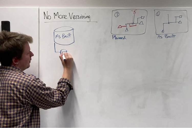
Check out the above video for a whiteboard session further explaining our approach to versioning, and if you have questions or would like to discuss in greater detail, feel free to reach out to us.