Connectivity modeling, or ensuring that fiber strands, splices, and equipment accurately mirror real-world configurations, is fundamental to fiber network management. In a recent poll conducted by 3-GIS, 40% of respondents answered that making logical connections and splicing consumed most of their time when it comes to network modeling.* Though challenging, streamlining this process is possible. Let’s explore a few ways to do so using 3-GIS | Web.
Understanding network connectivity in 3-GIS | Web
With support for strand-to-port, port-to-port, and strand-to-strand connections, 3-GIS | Web gives network operators greater visibility into the logical network, lending insight into every asset a signal traverses—including its physical location, any related infrastructure, and attenuation loss. This crucial information helps operators maximize network utilization and troubleshoot outages.
Managing leased fibers
Managing leased fibers is an ongoing challenge for telecom operators, as it often involves balancing fiber availability, ownership, and leasing details. 3-GIS | Web makes this task more manageable by providing a detailed view of fiber capacity and status, showing whether fibers are assigned, unassigned, or leased—allowing users to identify not only fiber ownership and assignments but also connection statuses. This makes it easier to plan network expansions or reroute connections when necessary and is especially useful when navigating scenarios with third-party fiber ownership.
Faster splicing
Splicing is a critical component of logical network modeling, especially when strands will be reserved for future network expansions. 3-GIS | Web streamlines the splicing process by configuring a splice point’s behavior upfront—including whether strands are connected, if a structure should be placed with the splice point, and what, if any, attribution is required to be populated (the information can even be required to be formatted a particular way). This approach creates a more efficient workflow by reducing the number of steps involved in creating a splice point and minimizing data omission.
Simplifying network modeling
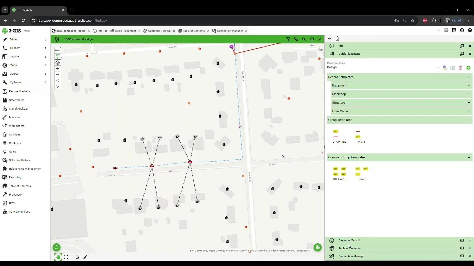
Complex connectivity modeling often involves coordinating multiple connections between equipment. 3-GIS | Web simplifies this process by allowing operators to establish predefined configurations for network assets. Templates can be created to enable users to quickly and easily place bundles of assets, including equipment, fiber, and infrastructure, or can include multiple pre-connected equipment commonly used together.
Overcoming challenges with the right tools
Managing network connectivity presents a range of challenges, from identifying leased fibers to dealing with outdated systems and workflows. Each of these obstacles can slow down network operations and create inefficiencies. By enabling seamless connection management, 3-GIS | Web allows users to visualize and model both the physical and logical networks, adjusting configurations as needed. This flexibility supports better decision-making and alignment with other network operations, enhancing the overall efficiency of network deployment, maintenance, and expansion.
*Poll results gathered during our recent webinar, Modeling connectivity in 3-GIS | Web. Learn more and access the recording here.


