The rollout of a fiber network is a complex, multi-phase process that involves meticulous planning, design, surveying, and execution. Geographic Information Systems (GIS) play a crucial role at each stage, ensuring that the network is deployed efficiently and effectively. In this blog, we walk through the various stages of fibre network rollout, detailing what takes place in each stage and what needs to be achieved.
1. High-level planning (HLP)
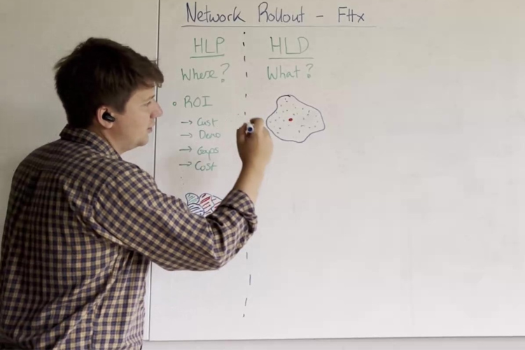
Objective: Determine where to build the network to maximise return on investment (ROI).During the high-level planning phase, the main goal is to identify the most promising areas for network expansion. This involves analysing several factors such as customer demographics, current network gaps, and competition. GIS and geospatial analytics come into play to map out potential regions and score them based on attractiveness for investment. Key considerations include:
- Customer base: Where are current customers located?
- Demographics: Where are potential customers similar to the existing customer base?
- Competition: Where are there underutilised areas with less competition?
- Cost of build: What are the estimated costs for building in these areas?
By the end of this phase, the output is a segmented map highlighting areas graded as good, bad, or neutral based on their potential ROI.
2. High-level design (HLD)
Objective: Develop an initial design and cost estimate for the chosen area.
Once the target area is identified, the next step is high-level design. This phase aims to sketch out a preliminary network design, focusing on:
- Cable sizing: Determining the size of cables needed based on estimated demand.
- Routing: Mapping out the potential routes for the network infrastructure.
- Clustering: Grouping clusters of houses or businesses that will be served by specific distribution nodes.
This phase provides a rough estimate of the costs and helps set up the groundwork for the subsequent field survey.
3. Field survey
Objective: Validate the high-level design and gather detailed data for low-level design.
In the field survey phase, teams go out into the field to inspect and validate the proposed network design. This involves:
- Capacity check: Assessing existing infrastructure to determine if it can support the new network.
- Route verification: Ensuring that the planned routes are feasible and do not face physical obstructions like large trees or existing utilities.
- Infrastructure assessment: Evaluating the usability of existing poles, manholes, and underground assets.
Field survey teams provide detailed notes and feedback, which are critical for refining the network design.
4. Low-level design (LLD)
Objective: Create a detailed, buildable network design incorporating field survey feedback.
The low-level design phase involves updating the initial design with the data gathered during the field survey. This stage focuses on:
- Updating design: Integrating field notes to ensure the design reflects real-world conditions.
- Connectivity planning: Determining the specifics of splicing and port allocation to ensure seamless connectivity.
- Buildable network: Producing a detailed design that construction teams can follow to build the network accurately.
5. Permitting and building
Objective: Obtain the necessary permits and prepare job packs for construction teams.
During this phase, the design teams support the construction teams by:
- Permitting: Providing local authorities with detailed reports to obtain permits for digging and construction.
- Job packs: Preparing comprehensive documentation (splice sheets, bill of materials, etc.) for construction teams.
Standardising the permitting process and job packs can significantly speed up this phase, which is often the bottleneck in network rollout.
6. As-built record updating
Objective: Ensure the documentation system accurately reflects the built network.
The final phase, often overlooked, is updating the as-built records. This involves:
- Updating inventory: Incorporating changes made during construction into the GIS system.
- Verification: Ensuring that the final design in the documentation matches what was actually built.
This step is crucial for future network management, customer turn-ups, and fault management. Accurate as-built records ensure that the network can be efficiently managed and expanded in the future.
Scaling for the future
The fibre network rollout process is a dynamic and iterative journey that requires careful coordination between various stages and teams. By leveraging GIS and focusing on meticulous planning, design, and documentation, companies can maximise their ROI and ensure a robust, scalable network infrastructure. Each phase builds on the previous one, creating a comprehensive system that evolves and improves over time. By standardising processes and focusing on continuous improvement, the entire rollout process becomes more efficient, paving the way for successful network deployments.
Look out for future blog posts where we will focus on the role 3-GIS plays in each of the stages detailed above. In the meantime, check out the below video for a whiteboard session which further explores the process of network rollout. If you have questions or would like to discuss in greater detail, feel free to reach out to us.

.png)

