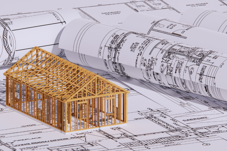
In the context of digital transformation, data management of conduits, strands, poles, manholes, and other elements of the outside plant have not typically been part of the discussion about the “digital network”. As network services become more dependent upon an increasingly complex network architecture, the physical network data has become more crucial for making business and operational decisions. Obtaining, documenting, and modeling the connectivity of this changing and extending network has not been easy.
One factor that makes gathering good data so difficult is the complexity of modern telecom communications networks with more layers being added in quick succession. To make matters worse, most carriers are often operating on hybrid networks with legacy equipment and software side-by-side with the latest digital systems and structures. All of this complexity makes delivering real-time accurate physical network connectivity a challenge.
What’s broken with legacy network management systems is that network owners have neither visibility of the utilization, availability, and geospatial location of each strand of their fiber assets, nor knowledge of how the fiber network conjoins with ancillary networks. 3-GIS software solutions are enabling service providers to have visibility of their fiber assets and to develop new business models to deploy and automate their physical network operations faster by using the information about those assets throughout their business operations.
The data created in 3-GIS during planning, constructing, extending, and maintaining the outside plant can be used by service providers to lend to the monetization of their assets, provide faster services to their customers, and improve operational efficiency to minimize errors which in turn helps both the top and bottom lines. But what’s so great about having a digital rendition of a pole, or cable, or manhole? How does digitizing the outside plant actually cultivate these enterprise-wide capabilities?
The simplest answer: a system that allows for accurate data on the location and relationship between all equipment and infrastructure that makes up the physical network enables service providers to use that data in all of their downstream projects and programs. You can see in the diagram below that the data created in the physical fiber build is being pushed through the business to allow for the following:
> Awareness of network utilization to inform market analysis and improve the customer experience and service quality
> Visibility of network availability for more rapid service activation
> Locating a single point of failure during an outage to allow for faster service restoration
> Confirming compliance and route diversity
> Better inventory and network management
> Accurate construction status reports to inform market promotions and sales campaigns
> Efficient fulfillment and billing efforts
> Service assurance to retain current customers
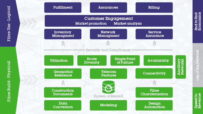
This data flow lays the groundwork for service providers to make more informed business decisions and lends to true operational excellence. Considering the ultimate purpose of digital transformation -- ensuring delivery of services to the customer and delivering operational efficiencies and automation -- 3-GIS | Network Solutions provides the data and the collaboration environment service providers need to derive better economics from their outside plant network investments.
Want to learn more about getting the most value from your OSP data?
Watch our webinar with TM Forum to hear from a few industry experts.